
How Big Is the Okavango Delta?
Size, Flood Extent, Dimensions and What They Mean for Your Botswana Safari
How Big Is the Okavango Delta, Ask five guidebooks how big the Okavango Delta is and you may get five different answers: 6,000 square kilometres, 15,000, 18,000, 22,000, even 40,000. None of them is exactly wrong. The Okavango is a living wetland that breathes in and out every year, swelling with floodwater from Angola and shrinking again under the Kalahari sun. Its size depends on the season, the year, and on what exactly you choose to measure.
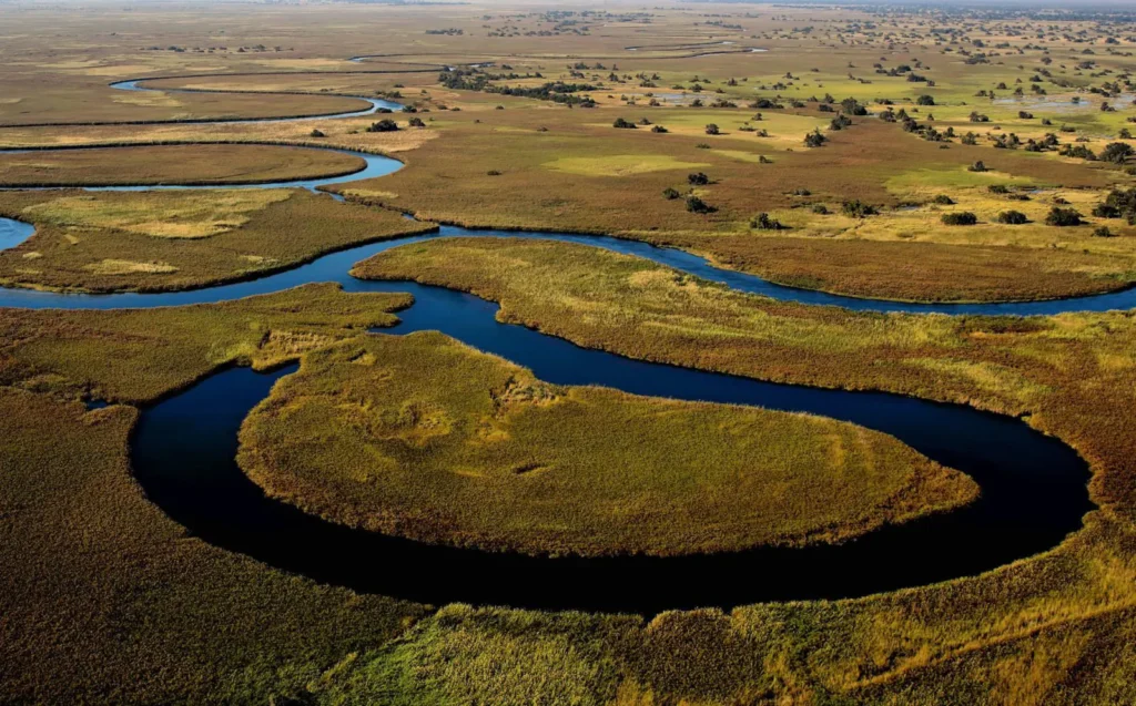
This guide unpacks every number. We explain the Delta’s permanent and seasonal footprint, its full alluvial fan, its protected UNESCO boundaries, its length and width, and how it compares with parks and countries you may already know, including the Serengeti, Rwanda and Uganda’s national parks. Finally, we show how the Delta’s scale shapes the way you plan, travel and budget for a safari there.
| Quick Answer: How Big Is the Okavango Delta?
Permanent swamp (low water): roughly 6,000 km² (about 2,300 sq mi). Typical peak flood: about 15,000 km² (about 5,800 sq mi), the figure most commonly quoted. Exceptional flood years: up to roughly 22,000 km² (about 8,500 sq mi). Entire alluvial fan, including dry islands: estimates range from about 28,000 km² to 40,000 km². Length and width: about 250 km from the head of the Panhandle to the southern tips, and up to about 150 km wide across the fan. |
What Is the Okavango Delta?
The Okavango Delta is a vast inland delta in north-western Botswana, in the Ngamiland district. It forms where the Okavango River, which rises in the highlands of central Angola and crosses the Caprivi (Zambezi Region) strip of Namibia, flows into the flat sands of the Kalahari Basin. Instead of reaching the ocean, the river spreads out into a fan of channels, lagoons, floodplains and islands, and nearly all of its water evaporates or is drawn up by plants.
This makes it an endorheic, or closed, system: a wetland in the middle of a desert. That single fact explains why the Delta’s size is so changeable. There is no fixed shoreline or sea level to anchor it. Its edges are set each year by how much water arrives from Angola, how much local rain falls, and how fast the Kalahari heat pulls that water back into the sky.
Geologically, the Delta sits in a shallow tectonic trough often described as the southern extension of the East African Rift System. Fault lines along its south-eastern edge, notably the Thamalakane and Kunyere faults, act like a dam that halts the water’s spread, which is why the Delta ends so abruptly near Maun.

Why Do Size Estimates Vary So Much?
The confusion around the Okavango’s size comes from three things: the season, the year, and the definition being used. Understanding them makes every published figure make sense.
The season: a flood that arrives in the dry season
Rain falls on the Angolan highlands between roughly October and April. That water then travels more than 1,000 km downstream, and because the Delta is astonishingly flat, the flood takes months to push through it. Water typically enters the Panhandle around March to April and reaches the furthest southern channels near Maun between June and August, exactly when Botswana itself is in its dry winter.
So the Delta is smallest during Botswana’s local rainy season (roughly December to March) and largest in the middle of the dry season. At peak flood it can cover two to three times its low-water area.
The year: big floods and small floods
Angolan rainfall varies a great deal between years, and the Delta responds accordingly. After a run of low floods in the late 1990s and 2000s, the early 2010s brought some of the largest floods since the 1960s. In a weak year the flooded area may barely exceed the permanent swamp; in an exceptional year it can approach 22,000 km².
The definition: water, wetland or landform?
Some sources measure only the area under water at a given moment. Others count all wetland vegetation, or the full alluvial fan including the thousands of dry islands, Chief’s Island among them. Others again quote protected-area or Ramsar boundaries, which deliberately include surrounding dryland buffers. The table below sets these measurements side by side.
| Measurement | Approximate Size | What It Includes |
| Permanent swamp | 6,000 km² (2,300 sq mi) | Areas under water all year, mainly the Panhandle and upper Delta |
| Typical seasonal peak | 15,000 km² (5,800 sq mi) | Permanent swamp plus seasonally flooded floodplains in an average year |
| Maximum flood extent | up to ~22,000 km² (8,500 sq mi) | Flooded area in exceptionally high-water years |
| Full alluvial fan | ~28,000–40,000 km² | The whole delta landform, including dry islands and rarely flooded edges |
| UNESCO core area | ~20,236 km² (2,023,590 ha) | The World Heritage property boundary |
| UNESCO buffer zone | ~22,866 km² (2,286,630 ha) | Surrounding protective zone around the core property |
| Ramsar site | ~55,374 km² | The Okavango Delta System wetland of international importance, including wide surrounds |
| Why 15,000 km² Is the Figure You See Most
Most safari operators, tourism boards and encyclopaedias quote about 15,000 km² because it represents the flooded Delta in a typical year at peak water. It is the most useful single figure for travellers, but remember it is an average, not a fixed boundary. |
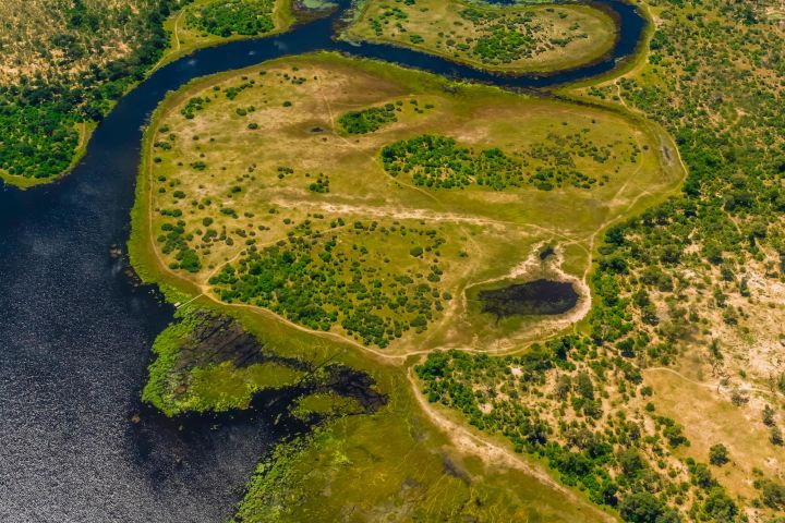
The Okavango Delta in Numbers
Beyond its area, several other measurements help capture the scale of this wetland.
| Feature | Figure |
| Length (Panhandle head to distal tips) | About 250 km |
| Maximum width across the fan | Up to about 150 km in big flood years |
| The Panhandle | A corridor roughly 100 km long and about 15 km wide |
| Elevation drop across the Delta | Only about 60 m over its full length, an extremely gentle gradient |
| Time for the flood to cross it | About four to five months |
| Okavango River length | About 1,600 km from Angola to the Delta |
| Okavango river basin | About 530,000 km² across Angola, Namibia and Botswana |
| Water lost to evaporation and plants | Roughly 95% or more of all inflow |
| Islands | Tens of thousands, from termite-mound islets to Chief’s Island |
| Chief’s Island | The largest island, roughly 70 km long and up to about 15 km wide |
| Moremi Game Reserve | About 4,870 km², covering much of the central and eastern Delta |
| UNESCO World Heritage listing | 2014, the 1,000th site added to the list |
The Anatomy of the Delta: Its Main Zones
The Delta is often compared to an open hand: the Panhandle is the wrist, the fan of channels the spread fingers. Each zone has its own size, character and safari experience.
The Panhandle
Where the Okavango River enters Botswana near Mohembo, it is confined between two parallel fault lines, forming a narrow, papyrus-lined corridor about 100 km long and around 15 km wide. Water is permanent here, the river is deep, and fishing, birding and boat-based travel dominate. Villages such as Shakawe, Sepopa and Etsha sit along its edges.
The Permanent Swamps
Below the Panhandle the river splits into major distributaries such as the Jao, Nqoga and Boro systems. This upper and central area holds water all year, with deep channels, papyrus and hippo-cut pathways. It forms the core of the roughly 6,000 km² that never dries out, and it is the domain of the mokoro (dugout canoe) and motorboat.
The Seasonal Floodplains
Further south and east lie the seasonal floodplains: grasslands, palm islands and woodland that are dry for part of the year and shallowly flooded for the rest. This is where the Delta ‘grows’ each year, and it is where the wildlife concentrations that make the Okavango famous are found, including around Chief’s Island and Moremi’s Xakanaxa, Khwai and Third Bridge areas.
The Distal Reaches and Fault-Line Edge
At the southern and south-eastern tips, the water spreads very thin before being stopped by the Thamalakane fault. The small remaining outflow feeds the Thamalakane River at Maun, and from there the Boteti River and, in big years, Lake Ngami. Only a tiny fraction of the water that enters the Delta ever reaches this point.
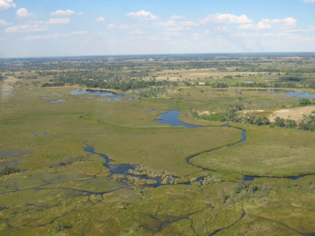
| Zone | Water Regime | Main Safari Activities |
| Panhandle | Permanent, deep river | Fishing, boating, birding, cultural visits |
| Permanent swamps | Year-round water | Mokoro, motorboat safaris, walking on islands |
| Seasonal floodplains | Flooded part of the year | Game drives, mokoro, walking, scenic flights |
| Distal reaches | Brief, shallow flooding | Game drives, horse riding, village visits near Maun |
How Big Is It Compared with Places You Know?
Numbers in square kilometres can feel abstract. These comparisons put the Delta’s scale in context, especially for travellers who know East Africa.
| Place | Area | Compared with the Delta |
| Okavango Delta (typical peak) | ~15,000 km² | Reference figure |
| Serengeti National Park, Tanzania | ~14,763 km² | Almost exactly the size of the Delta at a typical peak |
| Rwanda (whole country) | ~26,338 km² | The Delta in a record flood covers over 80% of Rwanda’s area |
| Murchison Falls NP, Uganda | ~3,840 km² | The Delta at peak is nearly four times larger |
| Queen Elizabeth NP, Uganda | ~1,978 km² | The Delta at peak is over seven times larger |
| Maasai Mara National Reserve, Kenya | ~1,510 km² | You could fit roughly ten Maasai Maras into the flooded Delta |
| Kruger National Park, South Africa | ~19,485 km² | Larger than the typical flooded Delta, smaller than a record flood |
| Northern Ireland | ~14,130 km² | Slightly smaller than the Delta at a typical peak |
| Put Simply
At its typical annual peak, the Okavango Delta covers about the same area as the entire Serengeti National Park. In a big flood year it grows to nearly the size of Rwanda, all of it a wetland sitting in the Kalahari Desert. |
Where Does All the Water Go?
Part of what makes the Delta’s size so remarkable is how much water it handles and how little of it leaves. In an average year the Okavango River delivers roughly 9 to 11 cubic kilometres of water into the Delta, and local summer rain adds several more. Yet the vast majority of this water, commonly estimated at 95% or more, is lost to evaporation and to transpiration from papyrus, reeds, grasses and trees. A small share soaks into the ground, and only around 2% flows out past Maun.
This is why the Delta cannot simply keep growing. Its outer edge sits where incoming water is balanced by evaporation. A bigger flood pushes that balance point further south and east; a smaller one pulls it back. The islands play a role too: trees on islands draw in water and concentrate dissolved salts, which over time helps islands grow and keeps the surrounding water remarkably fresh.
The Flood Calendar at a Glance
| Period | What Happens | Delta Size |
| Oct – Apr | Rains fall in the Angolan highlands; local rain in Botswana Dec – Mar | Smallest, close to the permanent swamp |
| Mar – May | Flood pulse enters the Panhandle and starts moving through the fan | Growing |
| Jun – Aug | Flood reaches the southern channels near Maun | Largest, peak extent |
| Sep – Nov | Heat and evaporation shrink the floodplains | Contracting |
Why the Delta’s Size Matters for Wildlife
The Delta’s shifting size is the engine of its extraordinary wildlife. Because the flood peaks in the dry season, it supplies fresh water and green grazing exactly when the surrounding Kalahari is at its driest. Animals move in from far beyond the wetland, concentrating on islands and along floodplain edges.
- Large herds: elephants, buffalo, zebra, wildebeest and antelope gather on the floodplains and islands as the water rises.
- Wetland specialists: red lechwe and the rare sitatunga thrive in the flooded grasslands and papyrus beds.
- Predators: lion, leopard, cheetah, spotted hyena and the endangered African wild dog follow the prey into the Delta.
- Birds: more than 400 bird species, including African fish eagles, wattled cranes, Pel’s fishing owls and huge breeding colonies of herons and storks.
- Water life: around 70 or more fish species, plus hippos and Nile crocodiles throughout the channels.
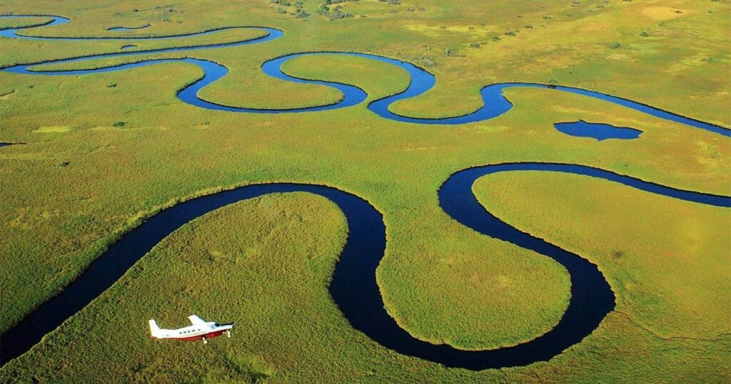
The sheer area also matters for conservation. A wetland this large, with so few roads and permanent settlements in its core, gives wide-ranging species like elephants and wild dogs room to move, and supports one of Africa’s most significant wildlife populations.
How the Delta’s Size Shapes Your Safari
Understanding the Delta’s scale is genuinely useful when planning a trip, because it affects how you get around, where you stay, and what activities are possible.
Getting around: flying is the norm
With few roads into its heart, most visitors reach Delta camps by light aircraft from Maun or Kasane. Flights between camps typically take 20 to 50 minutes, and the view from above is the best way to appreciate the size of the fan. Self-drivers can explore the eastern Delta through Moremi Game Reserve and Khwai, but water crossings in flood season demand a capable 4×4, recovery gear and experience.
Choosing your area
Because the Delta is so large, different areas offer different experiences. Water-based camps in the permanent swamps focus on mokoro and boating; land-based camps on the seasonal floodplains and in Moremi focus on game drives; mixed camps offer both. Combining two or three camps in different zones is the best way to see the Delta’s range.
Timing your trip
| Travel Window | Water Levels | Best For |
| Jun – Aug | High flood, cool and dry | Mokoro, boating, scenic flights, high game concentrations |
| Sep – Oct | Water receding, very hot | Peak predator and big-game viewing |
| Nov – Mar | Lowest water, green season rains | Birding, newborn animals, lower rates |
| Apr – May | Flood arriving, landscapes lush | Shoulder-season value, rising water activities |
| Planning Tip from Marriott Safaris Africa
If mokoro trips are a must, travel between about June and September, when the flood is high. If you want maximum game-drive time, consider September and October, when water is receding and animals concentrate. Our team can match camps across the Delta’s zones to the experience you want. |
Budget and logistics
The Delta’s size and remoteness are a big part of why it is one of Africa’s more expensive safari destinations. Light-aircraft transfers, the need to supply camps by air, and Botswana’s low-volume, high-value tourism model all add to costs. Mobile camping safaris and self-drive trips through Moremi offer more affordable ways to experience part of the Delta.
Protecting a Giant Wetland
The Okavango’s size depends entirely on water arriving from upstream in Angola and Namibia, which makes it vulnerable to developments it cannot control: dams, irrigation schemes, water abstraction, oil and gas exploration in the wider basin, and changing rainfall patterns. Even modest reductions in river flow could shrink the seasonally flooded area and change the habitats that wildlife depends on.
The three basin countries cooperate through the Permanent Okavango River Basin Water Commission (OKACOM), and the Delta’s UNESCO World Heritage status, together with its Ramsar listing, adds international weight to its protection. Botswana’s low-density tourism model, in which visitor numbers are kept relatively low, also aims to reduce pressure on this fragile system.
10. Frequently Asked Questions
How big is the Okavango Delta in square kilometres?
It ranges from about 6,000 km² of permanent swamp to about 15,000 km² at a typical annual peak, and up to around 22,000 km² in exceptional flood years. The full alluvial fan is larger still.
How big is the Okavango Delta in square miles?
Roughly 2,300 sq mi at low water, about 5,800 sq mi at a typical peak, and up to about 8,500 sq mi in a big flood year.
Is the Okavango Delta the largest inland delta in the world?
It is widely described as one of the world’s largest inland deltas, and often as the largest. Rankings vary depending on how the Inner Niger Delta in Mali and other systems are measured, but the Okavango is certainly among the very biggest and is the best-known.
When is the Okavango Delta at its biggest?
Usually between June and August, during Botswana’s dry winter, when floodwater from the previous summer’s Angolan rains finally reaches the southern parts of the Delta.
How long and wide is the Okavango Delta?
About 250 km from the top of the Panhandle to the southern tips, and up to around 150 km across at its widest in a big flood year.
Does the Okavango Delta reach the sea?
No. The Okavango River ends in the Kalahari Basin. Almost all its water evaporates or is used by plants, with only a small amount flowing out past Maun toward the Boteti River and Lake Ngami.
Is Moremi Game Reserve the same as the Okavango Delta?
No. Moremi, at about 4,870 km², is a protected reserve covering a large part of the central and eastern Delta, including Chief’s Island. Much of the rest of the Delta is divided into private and community concessions.
Can you see the whole Delta on one safari?
Not realistically. Most travellers visit two or three camps in different zones over five to ten nights. A scenic helicopter or light-aircraft flight is the best way to grasp its full scale.
Conclusion
So, how big is the Okavango Delta? The honest answer is that it changes: from around 6,000 km² of permanent swamp to about 15,000 km² in a typical flood, and up to roughly 22,000 km² in a great flood year. That shifting size is not a footnote. It is the reason the Delta exists as it does, drawing wildlife from across the Kalahari and offering safaris by mokoro, boat, vehicle and on foot in a single landscape.
Whether you want to glide through flooded channels in July or watch predators on the drying floodplains in October, the Delta’s scale means there is always more to discover. Contact Marriott Safaris Africa to plan a Botswana safari built around the season, the zones and the experiences that suit you.